Rare Events, Outsized Impact
Onsite continuous monitoring typically covers only 10% of sites — leaving the majority unobserved between scheduled inspections
AI-powered tools are needed to predict and target the most likely super-emitter sites before events occur
Sub-weekly flyovers of every site using open-data from European Space Agency and NASA satellites.
Compute-efficient model detects and quantifies methane plumes, attributing emissions to geo-located facilities.
High spatial resolution with a 150–200 kg/hr detection threshold. History back to 2015, near real-time today.
1/10th the cost of aerial flyovers. Designed for global scaling.
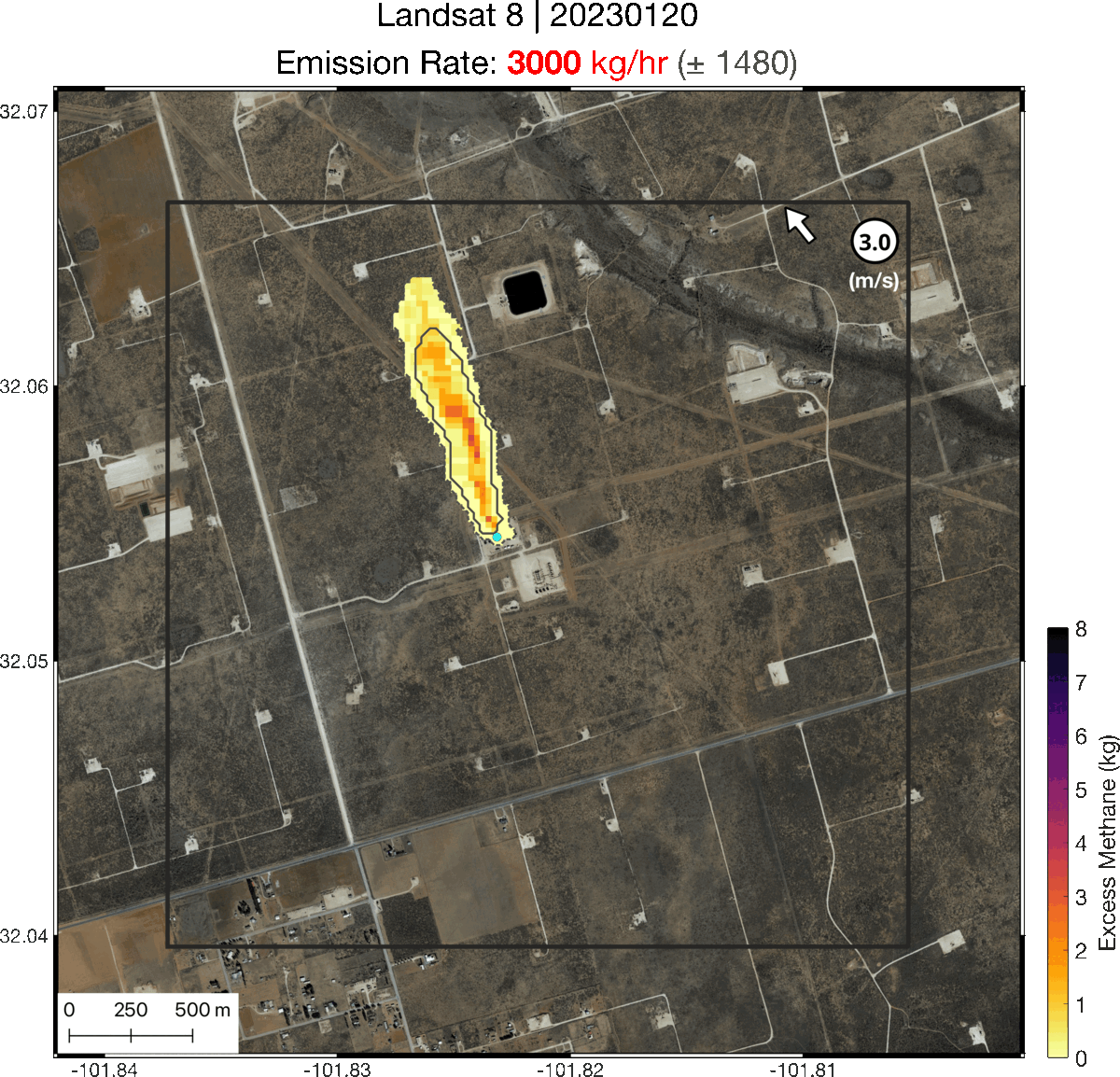
GEO's deep learning model processes satellite imagery to detect methane plumes in near real-time. Observed plumes are analyzed by GEO scientists and rated for confidence — similar to how radiologists assess medical imaging.
© 2026 GEO · AI-simulated methane plume
| Capability | MethaneScan AI | Aerial Flyovers | Free Satellites | Onsite Monitors |
|---|---|---|---|---|
| Weekly site revisit | ✓ | ✗ | ✗ | ✓ |
| Low cost | ✓ | ✗ | ✓ | ✗ |
| Full geographic coverage | ✓ | ~ | ✗ | ✗ |
| Plume quantification | ✓ | ✓ | ✓ | ✓ |
| No onsite visit required | ✓ | ✓ | ✓ | ✗ |
| History to 2015 | ✓ | ✗ | ~ | ✗ |

Boost sales to buyers of low methane natural gas
Strengthen your company brand & reputation
Retain and attract investors
Prioritize well abandonment sites by leak risk
Validate permanence claims for carbon credits
Innovation funded by U.S. National Science Foundation
geofinancial.ca