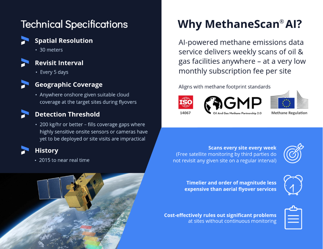
Low-cost breakthrough in methane management for managing risk, validating data and benchmarking
Use Cases and Benefits
“Weekly satellite-powered site scans are like a medical MRI. Now we can proactively and cost-effectively rule out significant problems, no longer “flying blind” at sites without continuous monitoring.”
Boost sales to buyers of low methane natural gas
Strengthen your company’s brand and reputation
Retain and attract investors
Prioritize well abandonment sites
Validate permanence claims for carbon credits
WHY MethaneScan AI SOLUTION WINS
VERSUS AERIAL FLYOVERS
Timelier and order of magnitude less expensive
VERSUS FREE SATELLITES
Scans every site every week
Free satellite monitoring by third parties do not revisit any given site on a regular basis
COMPLEMENTS ONSITE MONITORS
Fills coverage gaps where highly sensitive sensors or cameras have yet to be deployed or site visits are impractical
HOW WE DO IT

European Space Agency Copernicus Sentinel-2
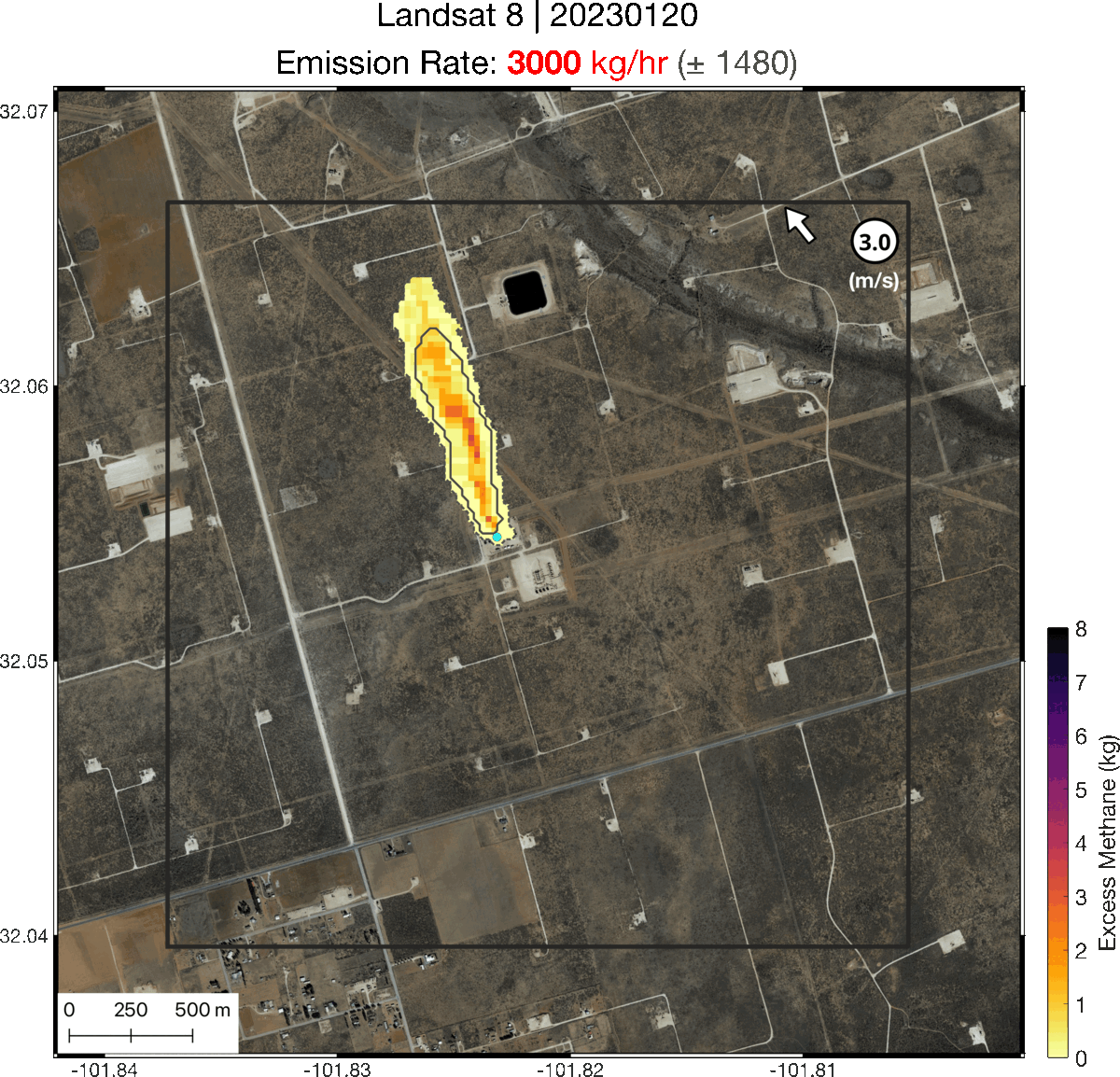
“GEO’s deep learning model detects methane plumes from subweekly high-resolution Space Agency satellite flyovers, delivering breakthroughs in coverage, refresh interval, and cost. ”
NASA Landsat 9
WHY METHANE MANAGEMENT IS CRITICAL
“Methane leakage from energy production and distribution is a solvable problem at relatively low cost, made easier by AI-powered satellite analytics which can now detect and quantify leaks at point sources.”

Methane is responsible for around 30% of the rise in global temperatures since the industrial revolution.
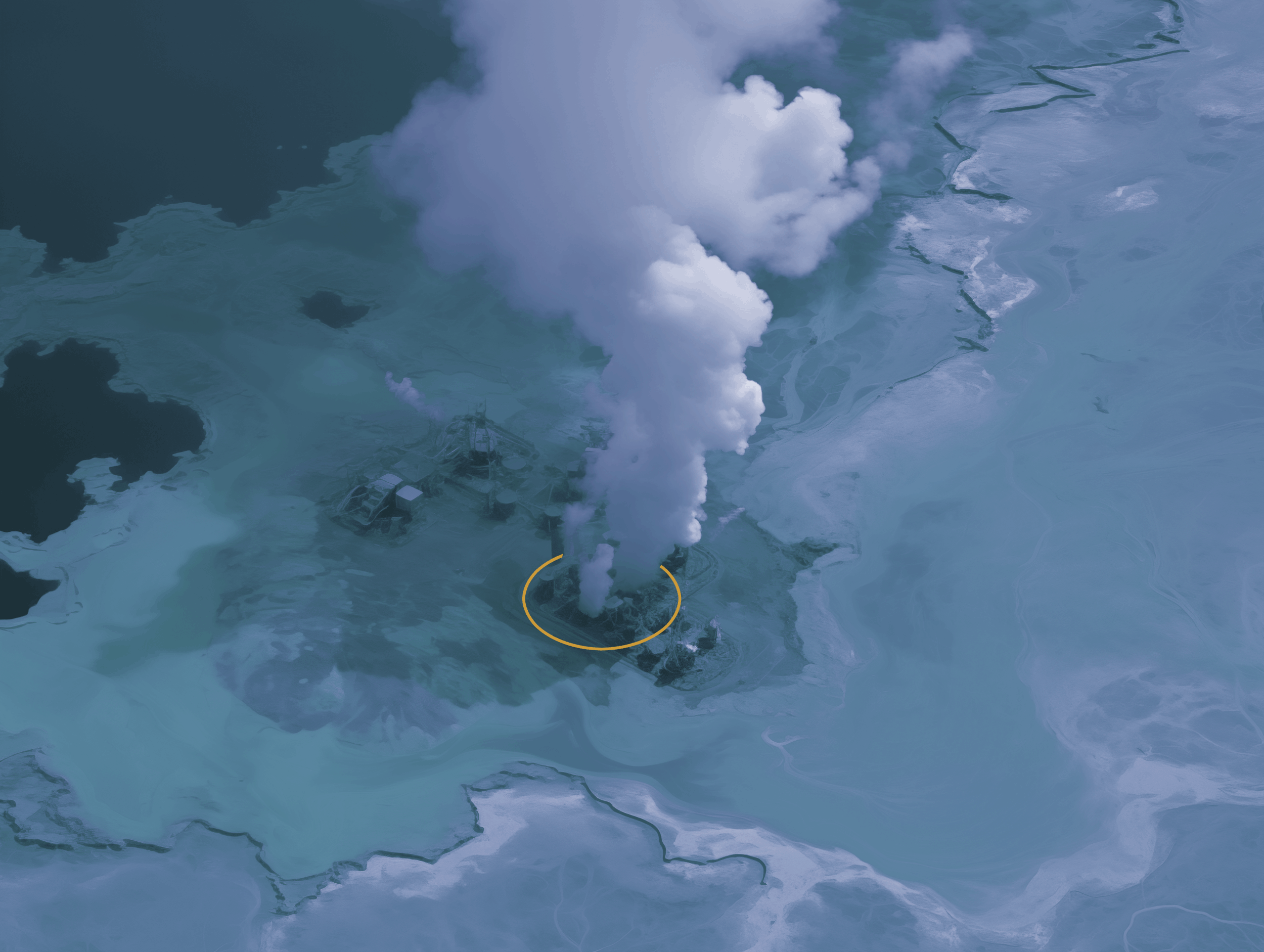
Image: AI-simulated methane plume © 2025 by GEO